
By Gaelen Means
Landscapes are inherently difficult to define since they are not the sum of static components, but rather a web of ever-changing elements that interact in untold ways. Picture a pasture greening in the spring– the grasses responding to what the soil gives it, the soil influenced by the activities of microbes, cows, and humans from seasons past, all of it responding to the weather, and existing within the specific context of local climate and geological processes that continue to slowly shape it. Landscapes are ephemeral yet eternal, singular yet ubiquitous, living and inert, and shaped through time by forces as large as tectonic shifts and as small as single-celled organisms. To fully understand landscapes or to capture their essence is impossible and yet, as humans, we must try because they are our very foundation. Landscapes are what root us, nurture us, and inspire us as a species and as individuals.
Landscapes underpin much of our work at Bio-Logical Capital; our mission is to transform how land is valued, developed, and protected. To achieve this work, we have to form some level of understanding of the biological, social, and economic systems that make up the landscapes in which we work. We find that tools such as observation, field work, and data collection yield considerable insight but are often further substantiated through mapping and spatial analyses.
“Landscapes are ephemeral yet eternal, singular yet ubiquitous, living and inert, and shaped through time by forces as large as tectonic shifts and as small as single-celled organisms. ”
We use mapping as a tool for communication and discovery, and as prompts to help us think differently. When learning a new landscape, and even sometimes when reevaluating a known one, maps provide an intuitive way to demonstrate the interplay between large systems, illustrate complex spatial patterns, and start powerful conversations. When crafted well, maps convey a lot of information quickly and help us form a consensus and build shared appreciation with stakeholders. Maps can also provide an expansive level of understanding that is otherwise quite challenging for small, self-centered beings such as ourselves. The relationships between locations and features can be described and teased out by looking at landscapes over different spatial and temporal magnitudes. Maps can help us grasp contexts and gain insights into, not only the influences on an area of interest, but also the role that area plays within a larger system. In our work, we look to overlay these learnings with a cultural lens, viewing humans (and their activities) in relation to their non-human counterparts.
Two of our recent projects help demonstrate the power that maps can bring to our work. In both cases, we used maps to help us learn a landscape and to help the people who already know these spaces intimately view them in entirely different ways.
Case Study I: Sea Level Rise in an Ecologically Rich River Delta
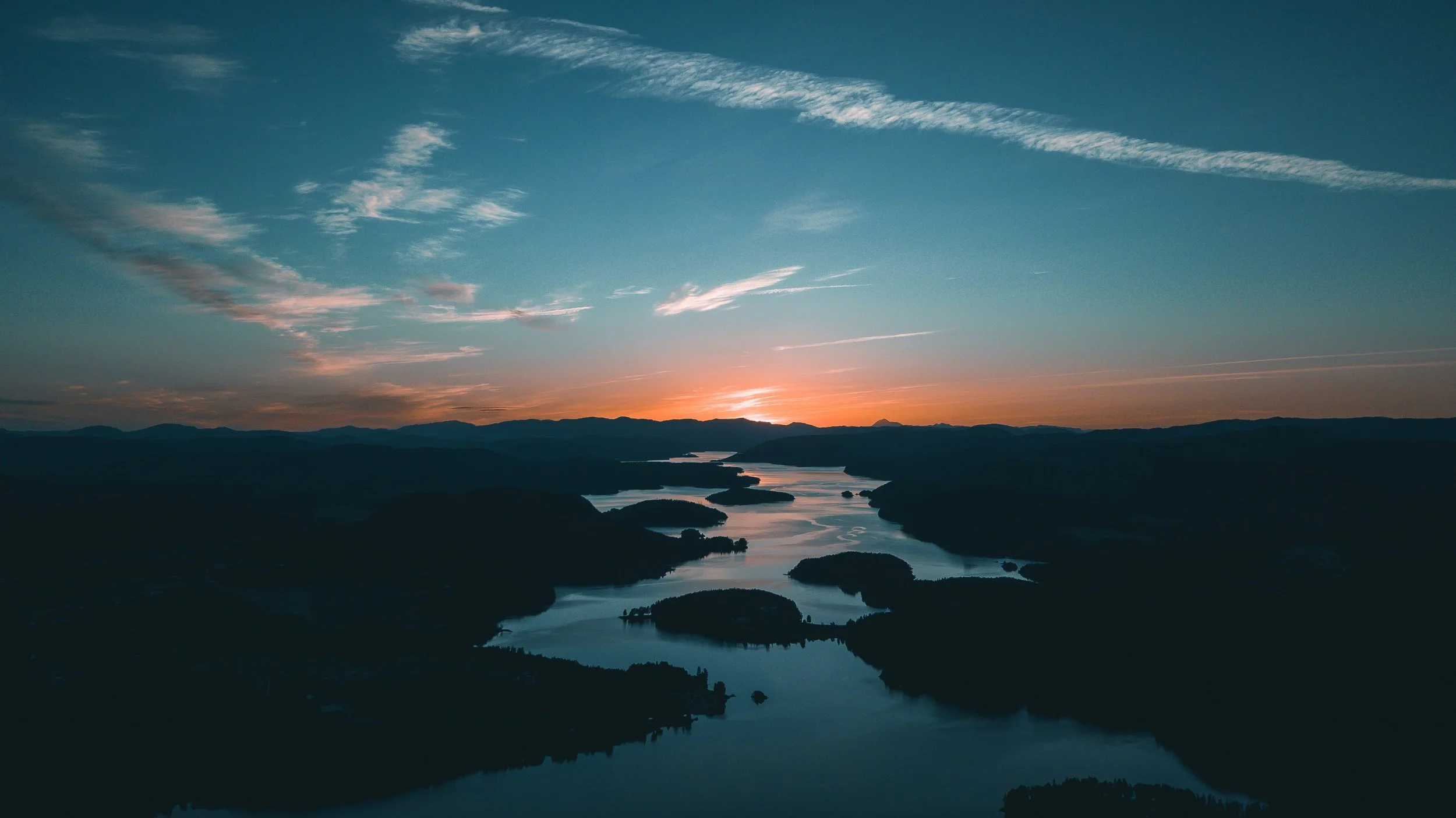
This first work example helped us to forecast how human activities globally impact activities locally. While maps are usually a snapshot, showing a place at a single moment in time, we used a series of maps to capture changes in a landscape spread out over decades: in this case, to depict sea level rise. The subject of the study is a rich and vibrant plot of land used by people for various agricultural and recreational activities, and to some, it is home. The land exists in a hydrologic sweet spot, where fresh water from a series of rivers meets the salty water of the Atlantic Ocean. The result is a brackish maze of languid channels and vast marshes that abound with American alligators (Alligator mississippiensis), fish, deer, and migratory birds by the millions. As is typically the case with such landscapes, the land in this area is remarkably flat, with very few hills that rise more than 10 feet above sea level.
Our goal in this work was to understand the site, its systems, and its context. Once that was established, we then set out to assess the potential for various revenue-generating activities which would integrate with the ecological systems of the delta and be viable in both the present economic and environmental climate as well as the uncertain future.
Click to expand all images.
Our analysis relied heavily on maps, augmented by on-the-ground observations and local knowledge, to paint a picture of the current and historic land uses and ecological systems. Additionally, we use these spatial tools to demonstrate future conditions, particularly with respect to sea level rise. Sea level rise, contrary to common belief, is happening at different rates around the world. In this location, sea level rise is occurring at a faster rate than most, due to a phenomenon known as subsidence, where land elevations are actually decreasing.
Using tools, analysis, and forecasting from the National Oceanic and Atmospheric Administration (NOAA) and other reliable sources, we were able to map the coastline into the future. These predictions vary widely in terms of the temporal expectations and subsequent impacts, but generally speaking, sea level rise is easier to predict than many other climatological changes such as species migration, weather, pests, and disease.
Since the level of the ocean changes with the tides, sea level is defined as the average point between high and low tides. For this analysis, we used the high water mark of a spring tide (the largest tides which occur when the moon is either full or new) in order to depict all areas that would experience regular flooding.
While, of course, our clients were aware of sea level rise and some of its potential impacts on these areas, viewing this sequence of forecasted maps was an eye opening experience for all of us. It is easy to largely dismiss such slow-moving threats as climate change when there is little direct evidence. This outlook can change quite drastically when you are able to visually comprehend the impending impacts on places you hold dear.
We were careful in delivering these materials and forthcoming about the inherent flaws of predicting the future. Nonetheless, these maps gave our clients a more concrete understanding of ways in which they could adapt to this changing landscape. Many of the activities that are currently taking place on the site will no longer be viable in the coming decades, at least not in their current form or location.
We combined this analysis with overviews of research on saltwater intrusion, marsh migration, and the uncertainty around changes in Atlantic storm frequency and severity (hurricanes). Together with rising sea levels, these factors all pose threats to the lands, marshes, and waters our client loves dearly, but also to the delicate balance of the ecosystems that make it so unique and vibrant.
Saltwater intrusion can impact the roots of trees and other plants even if the water has not reached the base of the plants. This process can result in the loss of trees near salt water bodies, especially as those water levels rise.
Marsh migration is a phenomenon where plant species adapted to different levels of inundation and salt exposure actually migrate up slope as seas rise, replacing other habitats as they move.
Although we often find ourselves telling hard truths, we also do our best to find pathways forward. In this instance, we were able to use a suitability analysis to identify upland areas, away from the impacts of rising seas and storm swells, that provide adequate soil and access for the rotational farming systems we designed for their site. We also provided additional options for revenue-generating enterprises, such as a hospitality business, which do not rely as heavily on the riskier lowland areas. While many factors played into our analysis and subsequent recommendations, sea level rise and its impacts became key drivers of decision-making around current and future activities on the site.
Case Study II: Ecological Corridors in a Sprawling Western Landscape
The upper Snake River watershed, which includes most of southern Idaho as well as parts of Wyoming, Nevada, Oregon, and Utah, is a vast landscape – vast not only in the sheer number of square miles that make it up, but also in terms of the scale of geomorphological features and relative lack of human development. As a mere human, standing in these spaces, you become acutely aware of your own insignificance. It can be a daunting, yet liberating experience. It is the type of place where you can stare off into the distance on a clear day and not know if the mountains on the horizon are tens or hundreds of miles away.
It was in this landscape that Bio-Logical Capital, with several project partners, embarked on a mission to connect some of the largest undeveloped and richest inland ecological areas remaining in the continental US today. On one hand, the Greater Yellowstone Ecosystem (made up of Yellowstone National Park itself at the core but including the areas surrounding it) encompasses nearly 20 million acres by some estimates. On the other hand, the rugged Northern Rocky Mountains of Idaho and Montana, including the Pioneer Mountains, the Sawtooth range, and the Salmon River watershed. Much of these areas are protected by a series of national forests, wildernesses, and national parks that stretch from the Snake River Plain to the Canadian border. Between these two revered landscapes lie premium ranchlands, as coveted and entrenched in the culture of the place as they are picturesque. These working landscapes are largely composed of grazing allotments on public land. In our eyes, these public grazing allotments presented an opportunity to strengthen corridors for migrating animals, open up habitat for far roaming predators, and allow DNA pools to co-mingle between these two areas.
Working alongside an inspiring local rancher and his family, we sought to study how the ranchers who work the land in this critical boundary region could shift their management models (which are often in conflict and in competition with local flora and fauna) to a model that is more aligned with the needs of the ecological resources of their area. At the same time, we hoped to preserve the culture and social fabric of the people, helping to create a more economically resilient model for a struggling industry. This “regenerative” model seeks to improve the richness and diversity of the landscape while making it more productive and adaptable to an increasingly unpredictable climate. Our local project partners have been implementing this approach over the last 20 years with much success. Our role in this work was to help communicate to others the importance of this goal and generate momentum around issues that are largely out of the public eye. Maps were key in conveying this message.
Using ecological data created by the Heart of the Rockies organization and other governmental and conservation organizations, we were able to understand the ecological resources of the region on a macro level and show other stakeholders what it was we hoped to accomplish. Additionally, we were able to identify the ranchlands most critical to creating healthy and functional corridors between different habitat zones. By studying an overlay of many layers of data, we were able to build a shared understanding of project goals, communicate a set of priorities, and plot our next steps.
These areas are some of the only areas in the conterminous US today which still support significant populations of species such as Grizzly, Lynx, Wolverine, and Wolves. These species used to proliferate in many more ecosystems across the continent.
The work on this project is not over, and we remain inspired by this landscape and its people. The hope in this work is to shift our collective perception of what conservation looks like and challenge the assumption that ranching is fundamentally at odds with diverse, functioning ecological systems. While protecting large areas of land from the heaviest human influences is critical, we believe models for working lands which allow for layers of ecological function and human habitation to coexist are the future of sustaining vibrant, healthy people and landscapes.
Conclusion
Just as we are, in large part, defined by the landscapes in which we are participants, humans are agents that act within and influence those landscapes, helping to weave threads though their fabric. At Bio-Logical Capital, our work centers around this idea; creating intention and purpose in the way we participate in the places that sustain us. As flawed and humble people, we recognize how this endeavor could be perceived as folly, however we do not strive to be perfect in our work, rather, we embrace messiness and failure as necessary parts of a creative process that leads us to new ways of being. What we do strive for is increased synergism with the places we inhabit.
“Make no mistake, maps are merely an interpretation of a chaotic reality, a simplified representation of an unknowably diverse place. ”
Mapping is not dissimilar from painting, drawing, or poetry. Through these mediums we attempt to demonstrate an idea, or set of ideas, while knowing that there are no answers, only ponderings. Mapping often departs from these other forms of depiction because, rather than being viewed as expression, it is viewed as more rigid and scientific. Make no mistake, maps are merely an interpretation of a chaotic reality, a simplified representation of an unknowably diverse place. Maps attempt to describe a landscape, but are static and simple compared to their subjects. They cannot help but pull some information forward and overemphasize it while shadowing or completely eliminating other fundamental elements. And just like other forms of expression, maps can cause us to feel and to imagine.
For us, maps can be a conduit for revealing opportunities for deeper understanding and knowing. When we use maps with purpose and acknowledge the inherent flaws, they can help us recognize the places we live, play, and work in entirely new ways, transforming our appreciation and heightening our awareness. Maps help us simplify the systems hidden within landscapes and also reveal the infinite complexity that makes them such compelling work subjects and partners.